- constellations tracked
- 6
- achievements to unlock
- 66
- accounts, ads or trackers
- 0
- offline
- 100%
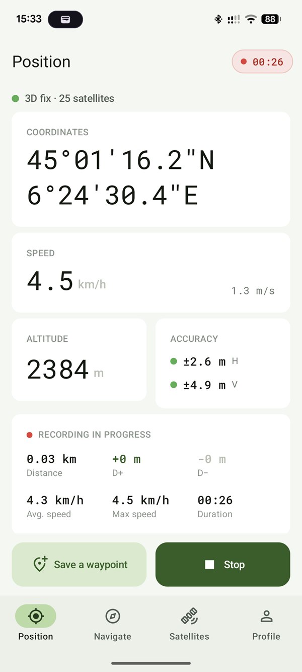
01 · Position
Know how much to trust your fix.
Decimal or DMS coordinates, EGM96 geoid-corrected altitude, speed in km/h and m/s. Horizontal and vertical accuracy are colour-coded so you can read them in bright sunlight.
- < 5 mprecise
- 5–15 mfair
- > 15 mdegraded
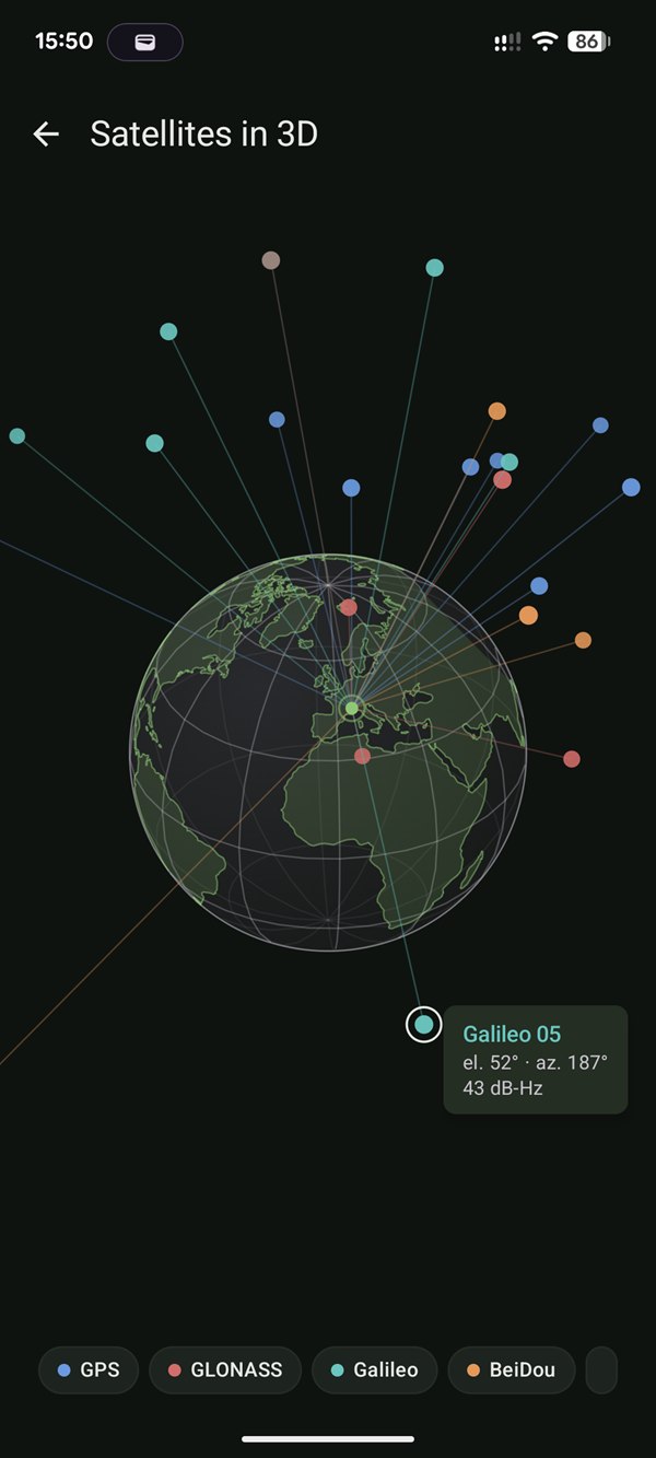
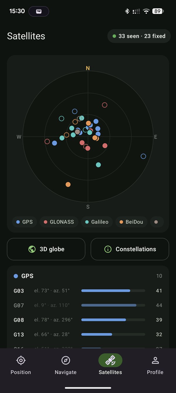
02 · Satellites
The sky, three ways.
GPS, GLONASS, Galileo, BeiDou, QZSS, IRNSS: see which satellites are locating you, where their signals come from and which ones are used in your fix.
- 013D globeThe real geometry of the constellation above you.
- 02Sky plotAzimuth and elevation of every satellite.
- 03Detailed listConstellation, signal strength, satellites used.
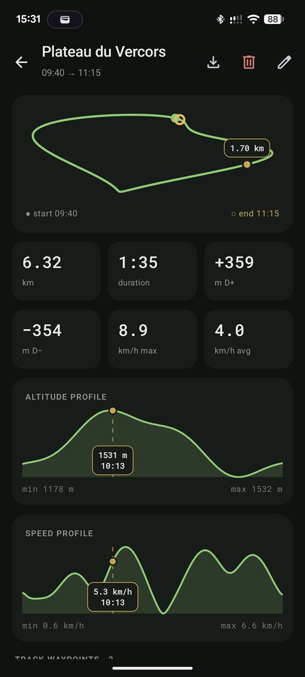
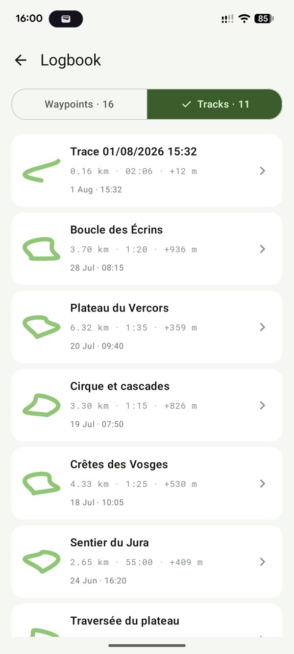
03 · Tracks & logbook
Pocket your phone, it keeps the track.
Recording carries on with the screen off: distance, duration, average and max speed, elevation gain and loss. Every outing lands in your logbook with altitude and speed profiles, waypoints and GPX export.
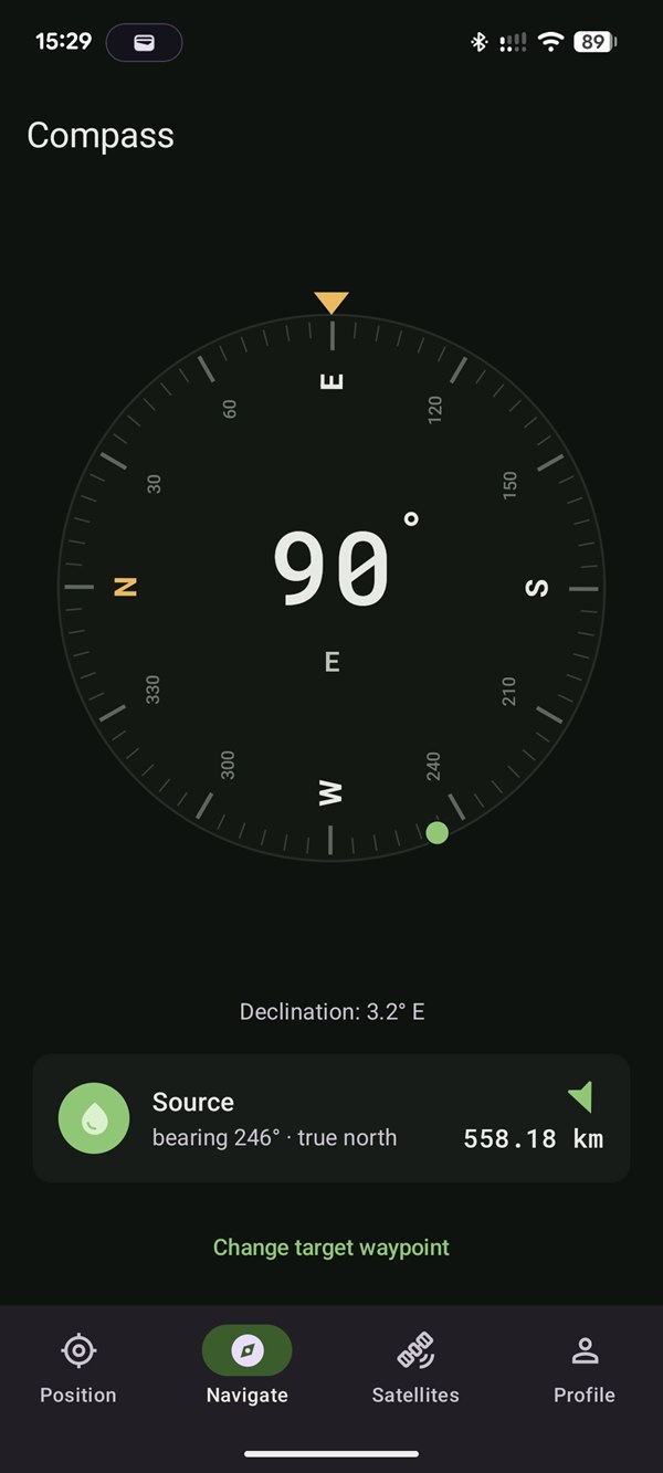
04 · Compass
Your heading, and the way to your waypoints.
Magnetic or true north, with locally computed declination. Pick a waypoint: an arrow, distance and bearing guide you there.
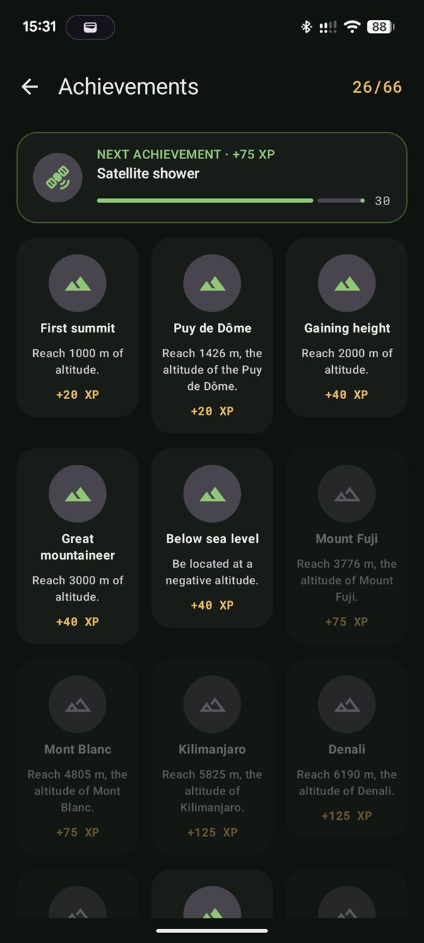
05 · Achievements
66 achievements to spice up your outings.
From your first summit to Kilimanjaro, from the 45th parallel to a waypoint saved before 6 am. Every achievement earns XP, and your personal records follow you from one outing to the next.
FAQ
Frequently asked questions
Does CairnGPS work without an internet connection?
Yes. Your phone’s GPS receives the satellites directly, with no mobile network or Wi-Fi. CairnGPS needs no connection for your position, the satellites or track recording: everything works offline, in the mountains as well as in airplane mode.
How can I see the GPS satellites my phone receives?
The Satellites tab shows every satellite on a sky plot by azimuth and elevation, lists its signal strength, and places the constellation above you on a 3D globe. You see how many satellites are in view and how many are used to compute your position.
Which satellite constellations are supported?
GPS (United States), GLONASS (Russia), Galileo (Europe), BeiDou (China), QZSS (Japan) and IRNSS/NavIC (India), depending on what your phone’s GNSS chip receives.
Why is the altitude accurate?
GPS measures a height above an ellipsoid, which can differ by several tens of metres from the altitude on maps. CairnGPS corrects it with the EGM96 geoid model to show the altitude above sea level.
Does track recording continue with the screen off?
Yes. Once a session is started you can pocket your phone: recording continues in the background and a persistent notification shows it. It never starts on its own, only when you start it.
Does CairnGPS replace a mapping app?
No: it shows no base map and does no routing. CairnGPS is a GNSS tool and logbook that complements your map app; GPX export lets you open your tracks in any software.
Do I need Google services to use CairnGPS?
No. CairnGPS uses neither Google Play Services nor Firebase, so it also works on phones without Google services. It is available on Google Play, on F-Droid and as an APK on GitHub.
Is CairnGPS free?
Yes: free, with no ads or in-app purchases, and open source under the AGPL-3.0 licence. It runs on Android 8.0 and later.
Privacy
Your tracks stay on your phone.
CairnGPS reads raw GPS through the Android APIs, with no Google Play Services, no Firebase and no tracking library. No account, no connection required. Read the privacy policy.
- Free software under the AGPL-3.0 licence
- No data sent anywhere, everything stays on the device
- Back up and restore everything in a single file
- Light and dark themes, readable in sunlight

Take the sky with you.
Free and open source, for Android 8.0 and up.